 Italia
 France
 Spain
Spain Morocco
 Mauritania
 Senegal
 Mali
Mali Burkina
 Ghana
Ghana Togo
Togo Benin
Benin Nigeria
 Cameroon
 Gabon
Gabon Sao Tomè
 Gabon 2
 Congo
Congo Congo DCR
 Angola
 Namibia
 Sud Africa
 Namibia 2
 Botswana
 Zimbabwe
 Botswana 2
 Sud africa 2
 Swaziland
 Mozambico
 Malawi
 Tanzania
 Rwanda
 Uganda
 Kenya
Kenya Etiopia
 Sudan
Sudan Egitto
 Libia
Libia Tunisia
 Malta
Malta
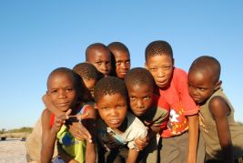
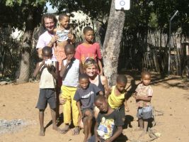

The Kunene River that flows east and the Kayango River (in Angola Cubango and in Botswana Okavango) that flows west, don’t just divide Angola and Namibia, but separate two completely different worlds; central Africa, its indigenous population somewhat unsettled and problematic in contrast to south Africa, European and more organized; we will discover them together… first we start off by driving on the left.
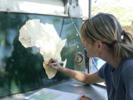
Entering Namibia we feel like we are arriving back home!
A country we have already visited.
A country, where, over the years I have worked.
A country full of memories... places and dear friends.
A country, that lest we forget is still Africa… and for the first time we are ripped-off at the frontier!
The visa on the passport is OK
A stamp on the carnet, everything is OK, but we ALWAYS have to pay attention to where they stamp and which part they tear-off, as many officials are not as clued–up as they might be and sometimes their improvisation can create a great deal of damage. We have to explain things, being careful not to patronize them or make them feel we are teaching them their job.
Payment for the “Cross Border Charge Permit” tax. This tax exists only in Namibia and costs 160 Namibian dollars (£12). It is a shame then that we have no NAD and there are no currency exchange offices. An eager frontier officer lends a hand by going into Angolan territory to exchange some currency for us. We hand over 30 US dollars (about 210-220 NAD), he returns and gives us 170 NAD, explaining that, this is all they gave him. I was thinking of giving him 5 euro (£4) for his trouble but it seems that he helped himself with a bit of an increase… Never mind.
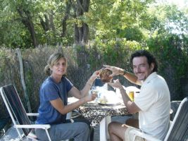
We celebrate anyway, with some spit-roast at the comfortable Rest Camp in Ondangwa.
GPS S17°54.726’ E15°58.483’
The owner is also a good mechanic. We take the opportunity and lubricate the K7.
In the evening, three South-African truck drivers invite us to their braai (S.African n. – short for Braaivleis – v. braaiing or braaing. Grill meat over an open fire).
We have some beer, conversation and barbecued ribs.
Flooding on the Northern Border
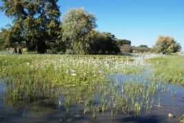
On the road towards the east, the land is soaked from the recent downpours that are still evident.
This is a curious Namibia full of water, she who is synonymous with deserts.
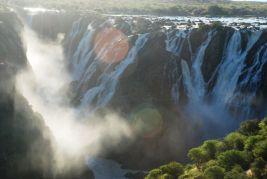
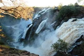
Ruacana the stolen waterfalls.
Raucana the stolen waterfalls.
These wonderful waterfalls exist only when the dam that closes the passage of the Kunen River in Angolan territory is open. Electricity is generated by this dam; the energy produced is used nearly exclusively in Namibia. The operators of this generated electricity system are all Namibian. Some time ago, the Angolans tried to take over the production but were abated by a quick and firm intervention by the Namibian government. An agreement between the two countries now exists in an attempt to control this delicate situation.
During this wet season, the waterfalls are magnificent. Summer tourists do not usually see this eye-pleaser because normally there is little rain that flows off from the dam.

Kunene Islands Campsite
The road that runs along the border created by the Kunene River starts to get rough.
We spend the night in the new wild Kunene Island Campsite (tot.100 NAD) where we finally light our first fire on our own.
Beside us, with his family, we meet Jan Arnold, who organizes trips and excursions along the dirt roads in Namibia and Angola.
Kunene River Lodge
We travel slowly.
We need to slow the pace down that we adopted in Angola.
We travel a few dozen kilometres up to the Kunene River Lodge.
This famous campsite lies on the bank of the river and is very beautiful.
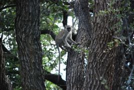
Monkeys shimmy around in the trees overhead.
Monkey photos
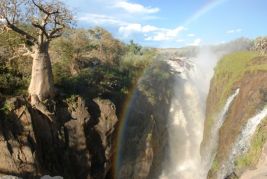
Epupa Falls
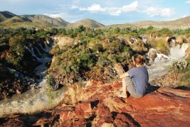
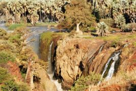
We reach these spectacular and thrilling waterfalls on the border between Angola and Namibia, after travelling along the only road; a laborious trip along a rocky track amongst Mopani trees and spiky acacias,
Of three possibilities available, we choose to camp at the first campsite.
It has a view of the rapids and its profits go to help the local community.
GPS S17°00,125’ E13°14.700’
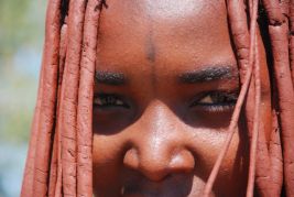
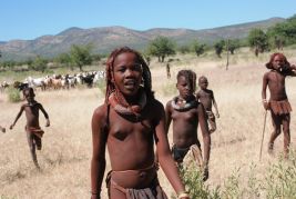
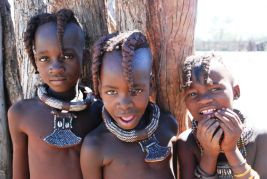
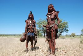
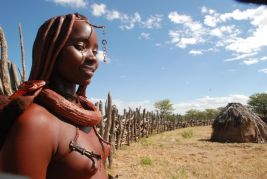
This is a famous and typical Namibian ethnic group.
The members of its families traditionally walk around almost naked and cover their bodies and hair with ointments made from spices, fat and earth.
They breed livestock and therefore are quite well-to-do.
The boys wear a plait facing forwards.
The girls wear two, like horns.
The teenage girls usually wear their hair long but can wear it how they want to, whilst the married women wear a crest made of cow-leather.
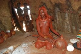
Their huts, have only one opening and are caked in cow manure and mud.
On the inside, they light a fire in the centre to cook and to keep warm.
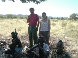
Okangwati Orphanage
A sign by the roadside informs of the construction of an orphanage. We make plans to pay a visit. We meet Gisela and Andreas who moved here a few years ago from Berlin. They are building some bungalows that will be available to tourists and help support the orphanage project.
In this isolated place, the rough roads make it difficult to obtain provisions and supplies.
We decide to leave an Elfo token (details in solidarity).
If you happen to be passing-by, and need to stop, you will be welcomed guests and at the same time, you would be helping them too.
GPS S17°25,190’ E13°16,395
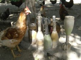
Strange bombs - ?
Occasionally, they still find mortar bombs lying around.
We are on the border of Angola, where up until the 90’s they were at war with the South-Africans that occupied Namibia…
Fortunately, now only the chickens are interested in these devices.
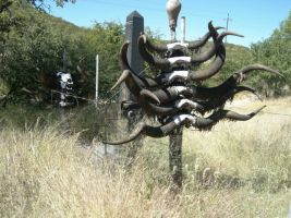
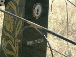
Strange Tombs - ?
We cannot understand, to whom this memorial - worthy for any cowboy, is dedicated.
There is a picture of a cow on the marble. (?)
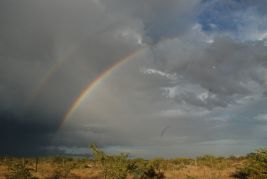
The storms in these vast areas are always spectacular.
Here on the western border of the Etosha Park, right in front of the closed entrance, we camp in the wild and fascinating Hobatre Camp Site.
GPS S19° 18.665’ E14°28.750’
Otjitotongwe camp – 9 May 2008
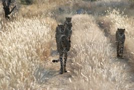
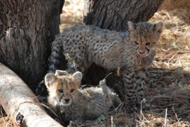
Heading towards the huge Etosha Park, we are intrigued by a sign by the road, which indicates Cheetah Guest-farm.
We do not know whether that is just the name or if there really are cheetahs.
We decide to investigate.
We stay three days.
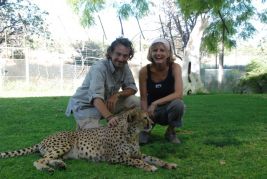
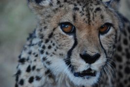
There are three of them guarding the courtyard.
Their owners reared them and it is possible to touch them…
…with caution.
Relax-days’ always entail small jobs.
We check all the oil levels… OK
Secure all the bolts on the roof rack.
We check the tightness of all the other screws, like the ones on the shock absorbers, the front and rear struts, etc.
We replace the fuse on the special battery charger.
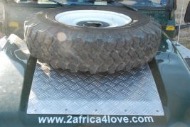
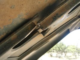
The bonnet has buckled under the weight of the spare wheel and subsequent contact with the air conditioning compressor has cut one of the metal members.
It is now also rubbing against a metallic tube that takes fuel to an injector and the oil cap.
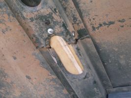
We will have to weld and strengthen the whole structure, but the sheet metal is very flimsy and we will need to go to the city to find a good welder, who charges a fair price.
For now, I manage to straighten and strengthen the bonnet by improvising in true ‘African’ style with three screws and a piece from the box of our kitchen.
Etosha – 12 May 2008
After paying 25euro (£20) to make an update on the internet (!!!), we enter Etosha.
The big national park in Namibia.
Last year it celebrated its 100th year.
We begin two days of safari.
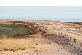
In this season there is a lot of water and the Pan, usually a very dusty desert, today looks like a huge lake.
This will make it very difficult to see the animals because they will not group together amidst all the puddles.
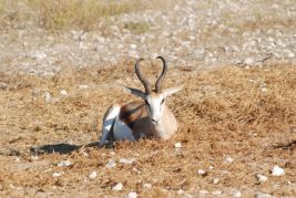
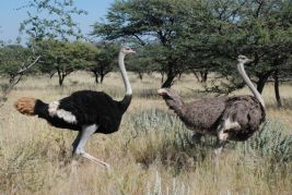
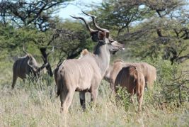
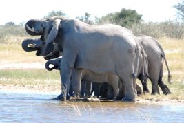
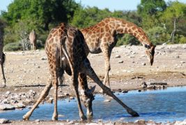
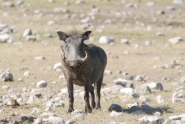
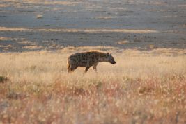
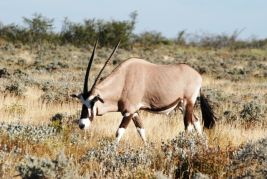
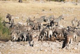
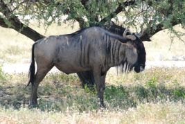
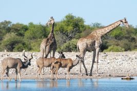
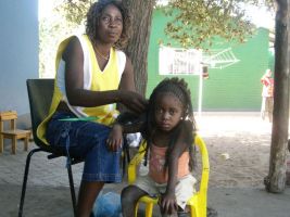
Here are the pictures of our find:
Mangetti Dune – 14 May 2008
We sleep at a campsite called Olea in GrOotfontein.
GPS S19°33.614 E018°06.528
We visit an orphanage in the region of the San. After covering a few hundred kilometres, we eventually arrive at the Mangetti Dune.
During the occupation of Namibia and the recent war against Angola, there were South-African military bases here.
Once the troops had left, all the buildings were destined to become dilapidated. However, thanks to a handful of people making an effort, these buildings have been put to proper use.
We meet Doctor Melitta, a great humanitarian and other interesting people.
We leave two Elfo tokens (details in solidarity).
Olivier and Mike
Now here are two very interesting characters.
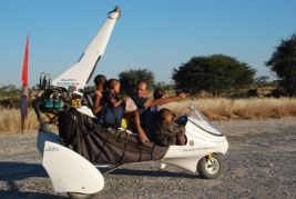
Olivier Aubert (Swiss) and Mike Blyth (South African)
They are passionate and great microlight experts, and they are on an unbelievable journey starting from the bottom of South America to the extreme top of Greenland, and now on to the extreme south tip of Africa.
Their website is: www.trike-expeditions.com
In this area, they are making and shooting footage for French T.V.
They take us for a fly.
FANTASTIC!
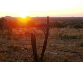
Going South! Towards the capital city – 16 May 2008
Next, we pass the Waterberg Plateau Park that we visited a few years back, so we decide not to stop.
We stop at the Hohenfels camp for the night, very cheap but very beautiful (Nearly 20euro, (£16)
GPS S21°41.900 E016°50.551
We stop at the big market in Okahandja to buy some things to raise money at the markets of the Elfo solidarity.
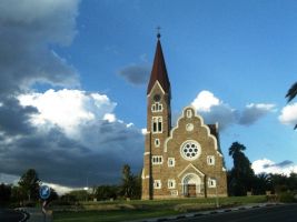
Windhoek – 16 May 2008
We finally arrive in the capital city.
The evenings are starting to get chilly.
We wear shirts during the day but during the night, we sleep in our thick sleeping bags to combat the 6 degrees.
We camp at the Chameleon City Backpackers. A nice place in the centre and not to expensive (10-euro - £8, with breakfast) GPS S22°34.445’ E017°04.903’
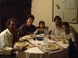
We have to stay a few days in the Capital.
There’s no time for tourism, we will do that in about 2 months time, when we will come back here.
Instead we visit a couple of dear friends who live here and spend a few days with them.
Here are Ute, Nel, Kean and Jana.
We celebrate a birthday and enjoy a lovely Namibian meat based lunch a-la braai and an Italian dinner, an Emilia-Romagna dish, with tortellini and balsamic vinegar.
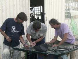
Luckily there is a wizard of sheet-steel in the family, so, we make the most of him and have him repair our broken bonnet with ‘luxurious’ reinforcement.
Since I am already here, we replace 13-rivets from the broken bodywork. I start checking the oil levels and find an oil leak from the power steering. I put a second steel-band around the spot where I think it is leaking. There is little oil missing from the container, which I fill it up. I will keep an eye on the situation to keep it under control.
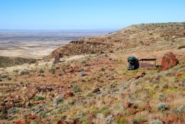
Brukkaros crater – 23 May 2008
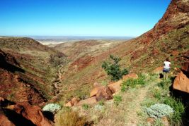
Along the road heading south, there is the crater of an old inactive volcano.
The place is out in the wild and very rarely busy.
You can camp, but you need to take everything with you, including water.
GPS S25°53,116' E017°46,944'
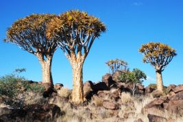
Quiver Tree Forest – 24 May 2008
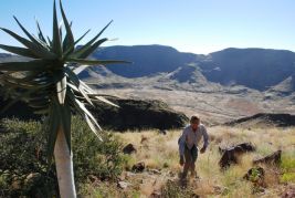
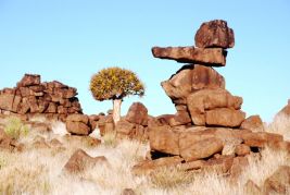
Further south there is a forest of strange looking trees - aloe dichotoma, also known as Quiver tree or Kokerboom. They are not trees, so much as fat plants.
They only flower after 30 years and, as it happens, during this period.
The oldest examples are 300 years-old.
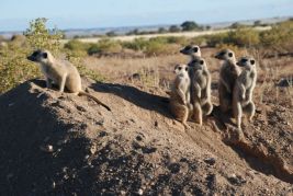
Near to the Quiver forest, there is a campsite with very interesting animals: cheetahs and the lovely meerkat or suricate, always cautious and alert.
GPS S26°28,881' E018°14,281'
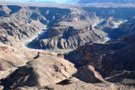
Fish River Canyon – 25 May 2008
It is one of the largest canyons in the world; second only to the famous Grand Canyon in the USA. It features a gigantic ravine, hollowed out milleniums ago.
You can trek right across it from Hobas in the north all the way to Ai-Ais 80km south.
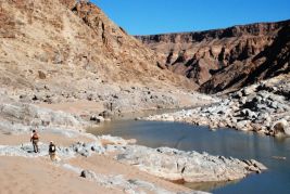
The 500-metre high ravine is also a shore to the river and is made of crumbly, brittle red rock.
This is the only guide for trekkers during their journey; there are no places on which to rest or obtain water. Everything has to be carried, enough for the five or six days that it takes: water, food, clothes, and sleeping bags and if possible, a tent.
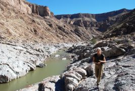
We decide to stop-off; we come out 18km after the start point along the only road from the main road.
We start with 500m of steep slope. Once you have reached the bed of the river you can walk on sand and rocks. It is like walking along a reef; difficult, but what a beautiful place.

We follow the course of the Fish River for 18km with two fords that we cross bare-footed. We climb a steep bank, full of loose stones.
Within an hour and a half, we are on the plateau.
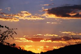
Just in time to watch the sun go down.
This excursion lasted 8 hours.
We leave Namibia – 27 May 2008
We will be here again during the first few days of July for our meeting with the 100km running event in the Namibian desert organized by ZITOWAY.
A southwards multi-coloured desert.
We at the frontier for only a few minutes and soon we are over the border.
The customs did not stamp our Carnet indicating that we have left the country; they tell us, that as they are a part of the same economic community of South Africa, then, they will stamp it…
All we can do is hope.
